The team you
want in your projects
A bit more about COMPLUTIG…
COMPLUTIG is a technology-based company at the University of Alcalá that was created in 2012 by a group of researchers and professors from the Department of Geology, Geography, and Environment. COMPLUTIG offers advanced solutions in geomatics and production of cartographic maps, based on technology transfer and know-how from the different research areas developed at UAH.
Daniel Reinoso, PhD
CEO
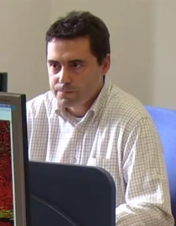
Mariano García, PhD
Remote sensing and LiDAR
Research and development lines: Methodologies to estimate forest structure through the use of passive an active remote sensing (SAR and LiDAR), analysis and processing of LiDAR data, and its fusion with optical and SAR data, characterization of fuel classes using LiDAR and SAR, biomass and carbon content estimation, assessment of vegetation moisture content.
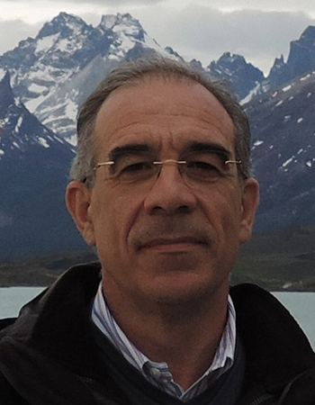
Prof. Emilio Chuvieco
Professor of Regional Geographic Analysis
Professor of Geography and director of the Environmental Ethics chair at the University of Alcalá, where he coordinates the Master program in Geographic Information Technologies, and
leads the “Environmental Remote Sensing research group”. Visiting professor at U.C. Berkeley and Santa Barbara, the Canadian Remote Sensing Center and the University of Maryland. He has given short post-graduate courses in 23 countries. Advisor of 42 Ph.D. dissertations. Principal investigator of 31 research projects and 23 contracts. Author of 29 books and more than 400 scientific papers and book chapters. Corresponding member of the Spanish Academy of Sciences since 2004 and co-editor in Chief of Remote Sensing of Environment. His main professional activity has been focused on the environmental analysis of satellite Earth observation, with particular emphasis on forest fire applications.
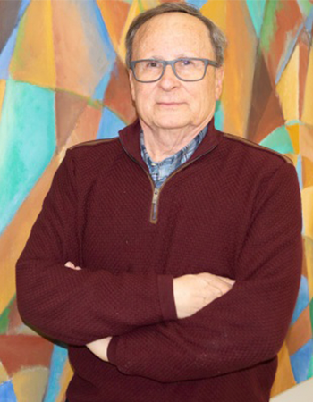
Prof. José Sancho
Professor of Geographical Regional Analysis
José Sancho is Professor of Regional Geographic Analysis at the University of Alcalá. He has directed more than 66 research projects oriented to cartography and rural development. He has 130 publication in books and research journals in that field. He also has experience in the organization and management of more than 80 courses with different institutes, foundations and enterprises.
José Ruiz
Cartography and Environment
Experience of more than 5 years in general and thematic cartography, from cartographic design to the edition of products for the National Atlas of Spain (National Geographic Institute) or the National Center for Geographic Information. He has worked in international projects for Equatorial Guinea and Angola José has also participated in environmental projects such as the Calculation of the Carbon Footprint for the municipalities in Sierra Norte de Guadalajara, with the collaboration of ADEL Sierra Norte.
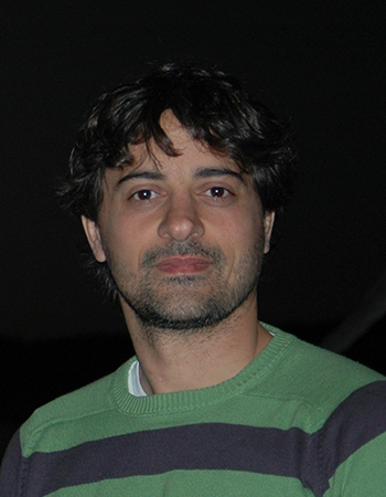
Rubén Ramo, PhD
Remote Sensing and Data Science
Graduated in Enviromental Sciences, MSc in Geographical Information Technologies and PhD at the department of Geology, Geography and the Environment of the University of Alcalá. Rubén Ramo has more than 7 years of experience in research and development in environment remote sensing and GIS. His main area of interest is the application of Machine Learning and Big Data in
the frame of earth observation, where he has several publications in international scientific journals.
Marta López
Cartography and GIS
Verónica Pascual
Cartography and GIS
Héctor Nieto, PhD
Remote Sensing and Numerical Modelling
10 years of postdoctoral experience and 40+ research papers in ISI indexed journals (h-index 15). Dr. Nieto has participated and lead several projects, working in international centres such as the USDA Agricultural Research Service, the University of Copenhagen and the Maison de la Télédétection de Montpellier. His research interests are modelling evapotranspiration and nutrient status with remote sensing over both natural vegetation and croplands, with
particular emphasis on the efficient use of water in heterogeneous canopies. Based on his research, Dr. Nieto contributes to open-source solutions for academic and non-academic users (https://github.com/hectornieto) .
Pablo J. Torres
Remote Sensing & Forest Health
In recent years I have focused my activity in two main fields, Remote Sensing and team management. I have been lucky to evolve and work within different projects at Rey Juan Carlos University, University of Alcalá and the Norwegian University of Life Sciences. My interest and activity are currently focused on the integration of different remote sensing technologies for their implementation at different scales in the field of Forest Health Monitoring.
Know more about the projects we have worked on